|

|
! NEW ! International Patent No. WO2014122256
Pocket LAI
*** Read entry in WORLD INTELLECTUAL PROPERTY ORGANIZATION database *** |
|
First
DIGITAL COMPASS for GEOLOGY ever bulit for Android based phones.
It is written in Java and requires Android v.
1.5 or above
Key
Features & Credits | User
Manual |
Download
version 1.0.11
Privacy Policy
*** Purchase the PRO version from Google Play *** |
|
 |
! NEW !
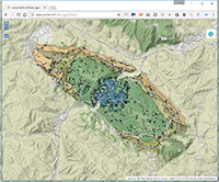
Still playing with old data: OpenLayers WebGIS map of Furlo Gorges
The nice "qgis2web" plugin of our beloved QGIS allows to create a fully portable verion of (mostly-) any QGIS Project we create: all data is converted to JSON and parsed by OpenLayers 3. Feature attributes can be queried with a click. Switch-off background layer for peering topmost ones!
- Access the WebApp - |
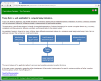 |
FuzzyWeb : an online web application for computing fuzzy indexes
Fuzzy-Calc allows to apply fuzzy logic for the calculation of indicators starting from an indefinite number of indexes in the form of continuous variables.
Developed using Wicket Web Framework and deployed on Google App Engine.
- Access the WebApp - |
 |
CI-Slam : a module for assessing susceptibility to hydrologically controlled shallow landslides
A model, developed in Java within the JGrassTools framework, to derive from geomechanical and hydrological parameters the Safety Factor map of a basin. The tool is based on the notable paper by Lanni, C. et Alii (2012).
- read the Tutorial - |
 |
Web Harvester: a Web Service client with RESTful interface
A Web Service Client prototype, developed in Php, that interacts through a distributed and service oriented architecture with tree Service Providers using SOAP messaging.
- try the client - |
|
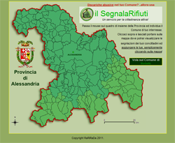
il SegnalaRifiuti
Google Maps mashup for illegal dumping control.
- link to application - |
|
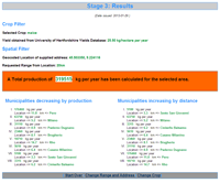
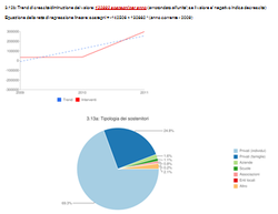
Dynamic stats with Google Chart API
Google Chart API used to create stats from dynamic dataset
- link to application - |
 |
Segnalazioni Via Web
per la Provincia di Pesaro ed Urbino
Google Maps mashup for provincial roads management.
- link to application - |
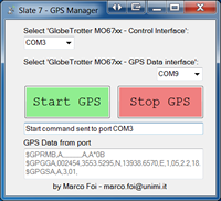 |
 GPS Manager for Samsung Slate 7 GPS Manager for Samsung Slate 7
Not GIS indeed.. ...but related to digital field mapping.
May you own a Samsung Slate 7, you could find my manual an tool useful for
first enabling then turning the GPS unit on and off.
- read the manual - |
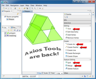 |
Porting of Axios Tools in uDig
Axios Spatial Editing Tool were ported in uDig core and are now available in uDig 1.3.2 (and following). Java coding in the Eclipse / uDig framework.
- view official blog post - |
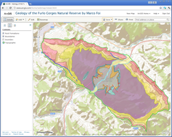 |
Geology of the Furlo Gorges in ArcGis.com
Some of the origilnal shapefiles
of the Furlo Gorges geological map,
displayed through the ArcGIS.com web service.
- view map - |
|
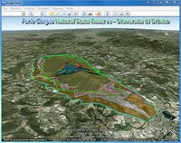
Geology of the Furlo Gorges in KMZ
A map of the geology of the Furlo Gorges State Reserve,
developed as part of my PhD Thesis.
- link to description and file download -

This work is licensed under a Creative Commons Attribution-NonCommercial 3.0 Unported License
|
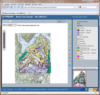 |
WebGIS Monte S. Giorgio UNESCO
Webgis of the UNESCO site: Monte San Giorgnio (CH - IT)
Developed using UNM
Mapserver 4.10 & pMapper.
- link to screenshots : no demo - |
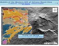 |
WebGIS W-Rift M.nt Etna
Webgis of the Western Rift of Mount Etna.
Developed using UNM
PHP MApscript 4.10.
Field Data: Bellotti F., Groppelli G.
- link to screenshots : no demo - |
|
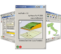
ArcProfili v.1.0.
ArcPad 7.0 customization for field data acquisition devoted to pedologic profile and soil description.
- link to application description with screenshots - |
| LINKS |
USED
SOFTWARE & TECHNOLOGIES |
|
|
Small .NET 2.0 tool to start and stop the internal GPS unit of the
Samsng Slate 7 tablet PC
|
|
|
Extensible
example of using SLD (Styled Layer Descriptors) for styling shapefiles
of geological content (dips, contacts, etc.) in BeeGIS/uDig |
| |
Geocoded Location stored as WGS84 Lat/Lon in
a database table serve the creation of on-the-fly marker in Google
Maps mashups.
PostgreSQL based (temporary offline) | MySQL
based |
| |
Google
Map's API: KML data managed with Javascript classes extension
by prototyping (many docs here). |
|
Small
Google Map mashup showing the "Front End" (view only)
of a myMap edited online using the standard Gaoogle Map account. |
Furlo
Field-Mapping Data
(discontinued) |
Openlayers
& Geoserver. |
GIT
2008 Offida: Field Trip Webgis
(discontinued) |
Openlayers
collecting data from Geoserver and Google Maps. |
Landslides areas:
slow
KML vs fast
TileLayer |
Google
Map's API: polygons loaded from a vector KML file (viewable also
with the NEW Google Earth browser plugin) or as a custom raster
TileLayer. |
| Furlo
Paths and Touristic points |
Google
Map's API: loading KML files. |