mcfoi.it
production
is proud to show:
Styling
geology with SLD inside BeeGIS and uDig
(18 july 2010)
Designed
and Developed by: Marco Foi
SLD (also known as 'Styled Layer Descriptor') allows for the custom
styling of vector and raster geographical data.
Many open source softwares dealing with maps support this kind of
markup language.
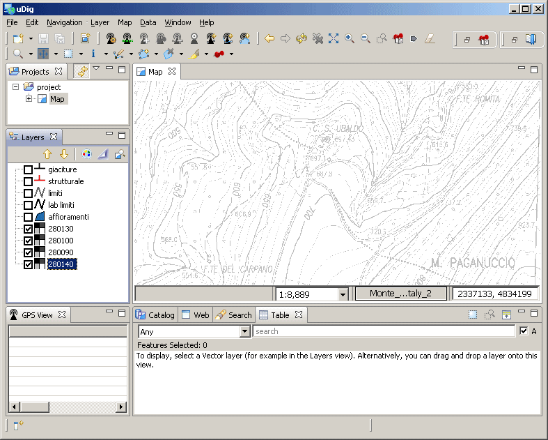
BeeGIS
and uDig
have been used to develop and test this example,
but the result could have been used to publish geological data
using the Geoserver framework and other WebGIS related software.
FEATURES
The proposed
styling was developed to enable effective usage of SLD capable GIS
softwares while dealing with geological data layers.
The example
only shows four layers whose content is thought as beeing collected
in the field,
while the fifth level (lab_limiti) should be the one used during office
work in the attempt to draw the definitive geological map of the area.
Styled layers:
| Layer name |
Layer content |
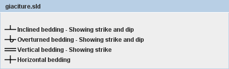
| "giaciture" |
Rock Bedding orientation showing dip and
strike |
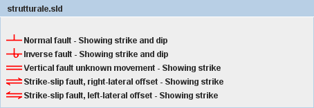
| "strutturale" |
Fault planes showing dip and strike |
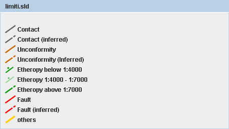
| "limiti" |
Contacts between rock formarions, as recognised in the field |
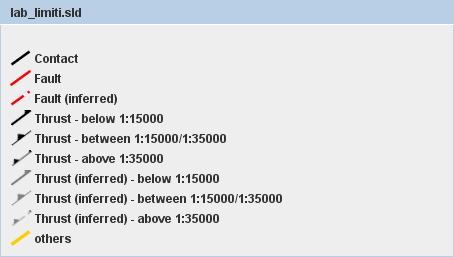
| "lab_limiti" |
Contacts between rock formations, as reworked in office post-processing |
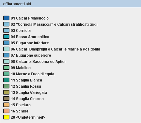
| "affioramenti" |
Outcrops location and extension (rock names refer to the Umbria-Marche
carbonatic succession [central italy]) |